In partnership with the Environment Agency
This page hosts materials for developers and FRA consultants about the Environment Agency’s new flood and coastal erosion risk data.
The Environment Agency is currently in the process of publishing updates to National Flood Risk Assessment (NaFRA2) and the National Coastal Erosion Risk Map (NCERM) data. These tools provide essential information for planners, and resources on this page are provided to help practitioners understand and use new information about flood and coastal erosion risk.
| LPA and LLFA staff interested in the role of the new data for development planning, should access Development planning (including Flood Map for Planning) instead. To request access please complete this form. |
On this page you will find:
- Briefing note explaining further changes to the Flood Map for Planning service, expected on 27 August 2025
- A short video to get an overview of the Flood Map for Planning service, with changes expected on 27 August 2025
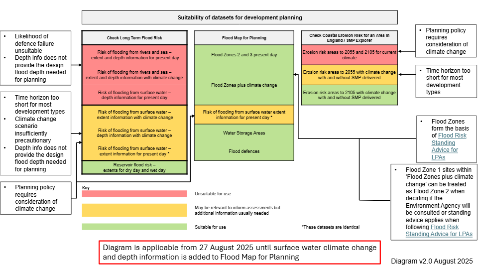
- An updated diagram explaining the suitability of the Environment Agency’s new flood risk products for development planning
- Briefing note for developers explaining the March 2025 changes to the Flood Map for Planning service
- E-learning courses
Announcement
The Environment Agency is making further changes to the Flood Map for Planning service based on user feedback. This change is due to be implemented on 27 August 2025. A new layer called ‘Flood Zones plus climate change’ will be added to the service. It will show how the combined extent of Flood Zones 2 and 3 could increase with climate change over the next century. Some of the existing layers are being removed from the service but will remain available on the Defra Data Services Platform. Find more information in the briefing note below.
Resources
1. Briefing note explaining further changes to the Flood Map for Planning service, expected on 27 August 2025
Read this briefing note to understand further changes to the Flood Map for Planning service, expected on 27 August 2025.
2. A short video to get an overview of the Flood Map for Planning service, with changes expected on 27 August 2025
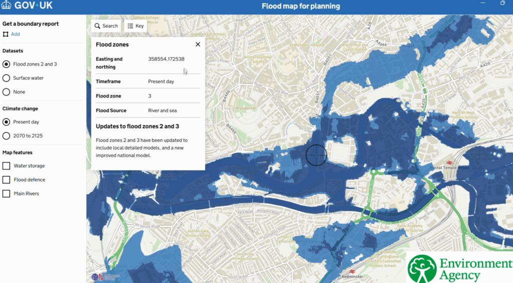
Click on the image below to watch the short video to get an overview of the Flood Map for Planning service, with changes expected on 27 August 2025.
3. A diagram explaining the suitability of the Environment Agency’s new flood risk products for development planning
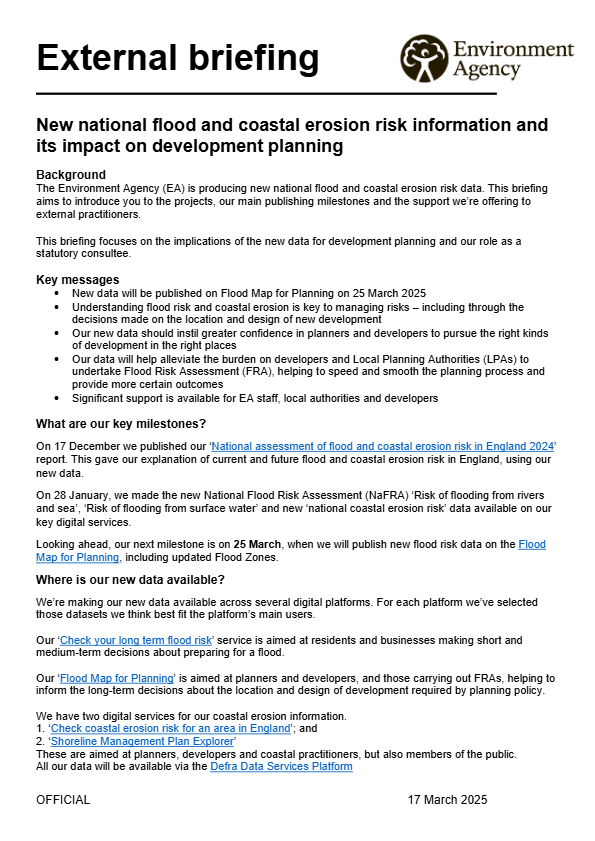
4. Briefing note for developers explaining the March 2025 changes to the Flood Map for Planning service
5. E-learning
The TCPA and the Environment Agency have developed a series of e-learning modules covering key policy and implementation topics around planning for flood risk in England. All resources are available here: https://learning.tcpa.org.uk/